Evolution of GNSS Surveying Technology
From Single-Point Measurement to Multi-Sensor Integrated Real-Scene Acquisition
In traditional field surveying work in the past, surveyors generally adopted the single-point measurement method to collect coordinate points one by one.
When working in complex environments such as mountainous areas, woodlands, urban construction sites and streets, single-point measurement is not only time-consuming and labor-intensive, but also confronted with a series of issues including satellite signal occlusion by tree canopies and high-rise buildings.
These problems result in unstable differential signals, poor satellite reception, and excessive deviation between collected coordinate points and their true positions.

Today, after decades of technological iteration, GNSS technology and its application logic have undergone significant transformations.
With the adoption and maturation of LiDAR, IMU and other technologies, as well as continuous improvements in satellite constellations and RTK algorithms, the workflow of the surveying and mapping industry is undergoing a revolution — shifting from the traditional single-point measurement paradigm toward multi-sensor integrated real-scene acquisition.

How can we measure Hard to Reach Points?
Click the picture to watch the video.
Today we will sort out the development context of GNSS technology and clarify the development trend of modern surveying and mapping.
Underlying GNSS Technology Iteration: Advancing toward High Precision and High Efficiency
The transformation of surveying workflows relies on continuous iteration and upgrading of GNSS software and hardware.
In terms of satellite constellations, a suite of satellite systems including GPS, BeiDou, GLONASS and Galileo work collaboratively to achieve global signal coverage.
The benefits brought by multi-constellation systems go beyond the option to switch between satellite systems. They can optimize GNSS satellite reception capability, delivering stable satellite signals in most complex working environments.
Even when operating in forested areas, mountainous regions and construction sites, the collected data becomes more accurate with smaller errors, further mitigating biases caused by environmental conditions.
At the hardware level, modern GNSS receivers have moved away from the bulky, high-power-consumption designs of the past and are evolving toward miniaturization, light weight, low power consumption and long battery life.
Iterative upgrades in chip and radio frequency (RF) technologies have greatly enhanced the signal processing capability of the equipment. Improvements in battery technology have substantially resolved the endurance issue; a single battery can support the receiver for a full day of field survey work.
Such technological advances have significantly boosted the efficiency of surveyors during field operations.
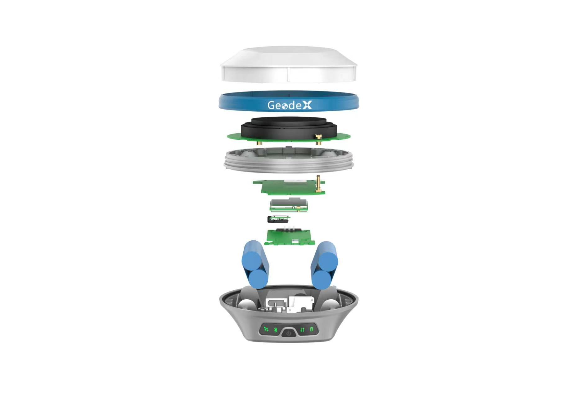
At the software level, modern GNSS receivers achieve centimeter-level accuracy based on carrier phase technology.
By utilizing multi-frequency and multi-constellation observation data together with statistical models, the initialization time for collected points is greatly reduced.
Combined with the Kalman filter framework, the device can automatically identify and mitigate interference caused by multipath effects.
Meanwhile, integrated inertial sensor data allows the receiver to maintain high-precision positioning results even during brief signal outages.
The iteration and application of these technologies undoubtedly greatly improve the efficiency and accuracy of modern field surveying.
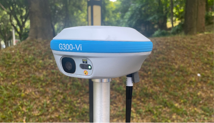
Geodex G300-Vi
Click the picture to see more details.
In addition, the popularization of the NTRIP network has freed the modern RTK surveying mode from reliance on local base stations.
The development and application of PPP technology enable a single receiver to easily achieve centimeter-level positioning. The widespread adoption of these technologies has greatly expanded the operational scope of GNSS.
A New Paradigm of GNSS Technology: Multi-Sensor Integrated Real-Scene Acquisition with GNSS + IMU + LiDAR
As mentioned at the beginning, surveying relied on single-point measurement for a long time in the past.
Under this mode, whether using total stations or RTK, surveyors had to manually measure each target point one by one and obtain discrete coordinates of these points group by group.
This method is time-consuming and labor-intensive. Furthermore, the acquired data may contain relatively large errors, requiring repeated measurements several times to achieve acceptable results.
However, when faced with large-scale infrastructure construction and extensive site surveys, the efficiency of single-point acquisition can hardly meet the requirements.
"Shifting to real-scene acquisition with continuous output of massive datasets" represents an entirely new operational logic that stands in sharp contrast to traditional single-point measurement.
Instead of waiting for manual trigger to capture points, operators only need to carry the device and move around the site. LiDAR and vision sensors continuously emit laser beams and capture images, automatically generating tens of thousands of spatial observations every second and continuously outputting massive 3D point clouds.

Each ground feature point obtained from laser echo is georeferenced using the global coordinate frame provided by GNSS and attitude data output by IMU, assigning real geodetic coordinates to all point cloud data.
There is no need to manually select feature points. The entire site environment, including terrain, trees, buildings, pipelines and fences, can be fully recorded.
When surveyors conduct field measurement work, the device continuously outputs abundant spatial observation data and completes the collection of site real-scene information in a single pass.
Compared with the traditional single-point measurement mode, it greatly improves the efficiency of surveying work for large-scale infrastructure projects.
Geodex’s latest laser RTK equipment deeply integrates GNSS, IMU and LiDAR functions. It not only retains the centimeter-level accuracy of RTK, but also can rapidly output 3D real-scene data, adapting to various complex field surveying environments to deliver the most efficient support for your work.
Vision for the Development of Next-Generation GNSS Technology
Even though current GNSS technology has become highly mature, GNSS surveying still faces challenges from various factors. Tall urban buildings and tree canopy occlusion can interfere with satellite signals. Although modern RTK technology incorporates many interference filtering algorithms to mitigate part of the adverse impacts, signal blockage remains a major challenge for the surveying industry today.

The industry is now turning its attention to low-earth orbit (LEO) satellite augmentation solutions. Current mainstream GNSS technologies primarily operate on medium-earth orbit (MEO) at an altitude of 20,000 kilometers. LEO satellites are much closer to the ground, delivering stronger received signals. Meanwhile, their rapid orbital motion provides richer observation data.
Nevertheless, LEO satellites will not replace existing GNSS systems; instead, they serve as a supplement and enhancement to current systems. In the future, LEO signals will be integrated into the existing sensor stack and work collaboratively with GNSS, IMU and LiDAR. This allows RTK surveying to maintain centimeter-level accuracy even in signal-obstructed environments.
Conclusion
Looking back on the development history of GNSS technology, the continuous evolution from early single-point coordinate acquisition to modern multi-sensor integrated real-scene acquisition has steadily promoted the digital transformation of the surveying and mapping industry.
The comprehensive upgrading and optimization of satellite constellations, RTK hardware and software, positioning algorithms, and multi-sensor perception capabilities have enabled GNSS technology to achieve higher efficiency and higher accuracy, pushing modern surveying technology to an entirely new level.

Geodex continues to delve deeply into GNSS surveying technology, committing to the engineering surveying field by developing stable, practical and highly efficient equipment solutions. If you wish to learn more professional knowledge about the surveying industry, welcome to consult our team and follow our ongoing updates.